The Cottage & Friars Pardon
Introduction
The photograph on this page of The Cottage & Friars Pardon by Stuart Logan as part of the Geograph project.
The Geograph project started in 2005 with the aim of publishing, organising and preserving representative images for every square kilometre of Great Britain, Ireland and the Isle of Man.

There are currently over 7.5m images from over 14,400 individuals and you can help contribute to the project by visiting https://www.geograph.org.uk
The Cottage & Friars Pardon
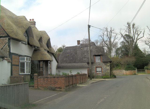
Image: © Stuart Logan Taken: 25 Apr 2013
Two more Grade II listed buildings in this ancient settlement, first recorded in the Domesday Book, the nearer is The Cottage with English Heritage Building ID: 321493 and dates from the 17th C. The contemporary Friars Pardon has English Heritage Building ID: 321494. More details of listed buildings in the village: http://www.britishlistedbuildings.co.uk/england/wiltshire/figheldean
Images are licensed for reuse under creativecommons.org/licenses/by-sa/2.0
Image Location
Latitude
51.224783
Longitude
-1.783574