
Ashton Canal
Introduction
The photograph on this page of Ashton Canal by Gerald England as part of the Geograph project.
The Geograph project started in 2005 with the aim of publishing, organising and preserving representative images for every square kilometre of Great Britain, Ireland and the Isle of Man.

There are currently over 7.5m images from over 14,400 individuals and you can help contribute to the project by visiting https://www.geograph.org.uk
Ashton Canal
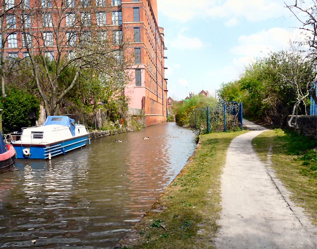
Image: © Gerald England Taken: 7 May 2013
Looking east along the Ashton Canal towards Cavendish Street.On the left, is Cavendish Mill which is a Grade II* listed former cotton spinning mill. http://www.britishlistedbuildings.co.uk/en-212750-cavendish-mill- It was built between 1884 and 1885 for the Cavendish Spinning Company. It ceased spinning cotton in 1934 and was then used for a variety of purposes before it was converted into housing in 1994. This last half mile of the Ashton Canal was a dead end in 1984 Image, as the Huddersfield Narrow Canal, its continuation, was abandoned and unnavigable. Now that canal has been restored and the Ashton Canal continues in a tunnel under the Asda supermarket.
Images are licensed for reuse under creativecommons.org/licenses/by-sa/2.0
Image Location

Latitude
53.483449
Longitude
-2.097459