Hastings Station
Introduction
The photograph on this page of Hastings Station by Simon Carey as part of the Geograph project.
The Geograph project started in 2005 with the aim of publishing, organising and preserving representative images for every square kilometre of Great Britain, Ireland and the Isle of Man.

There are currently over 7.5m images from over 14,400 individuals and you can help contribute to the project by visiting https://www.geograph.org.uk
Hastings Station
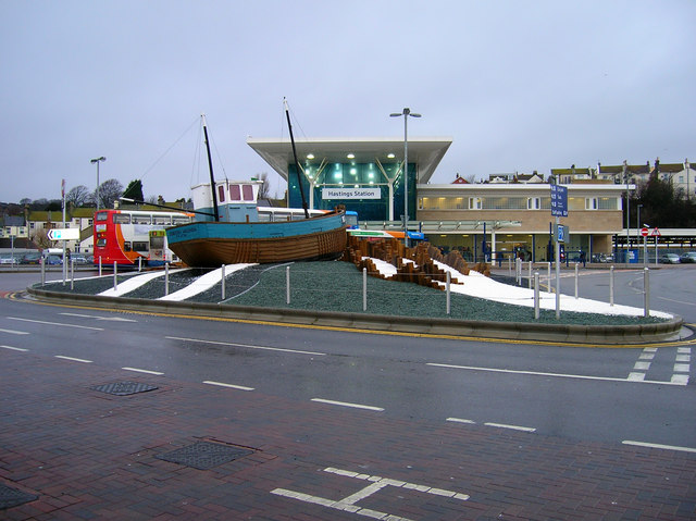
Image: © Simon Carey Taken: 21 Feb 2007
This is the third station building in Hastings. The original was built as a V shape in order to accommodate two railway companies, LSER and LBSCR, which operated out of the station. Various amalgamations meant the station building was redesigned in 1931. This building was replaced in 2004 by this nice shiny new one to make use of the land formerly occupied by the goods yard and also expand the layout in front (the previous station building extended round to the left of the picture) giving room for buses and cars alike. See Image for an explanation of the boat.
Images are licensed for reuse under creativecommons.org/licenses/by-sa/2.0
Image Location
Latitude
50.857811
Longitude
0.576453