Grimoldby: aerial
Introduction
The photograph on this page of Grimoldby: aerial by Chris as part of the Geograph project.
The Geograph project started in 2005 with the aim of publishing, organising and preserving representative images for every square kilometre of Great Britain, Ireland and the Isle of Man.

There are currently over 7.5m images from over 14,400 individuals and you can help contribute to the project by visiting https://www.geograph.org.uk
Grimoldby: aerial
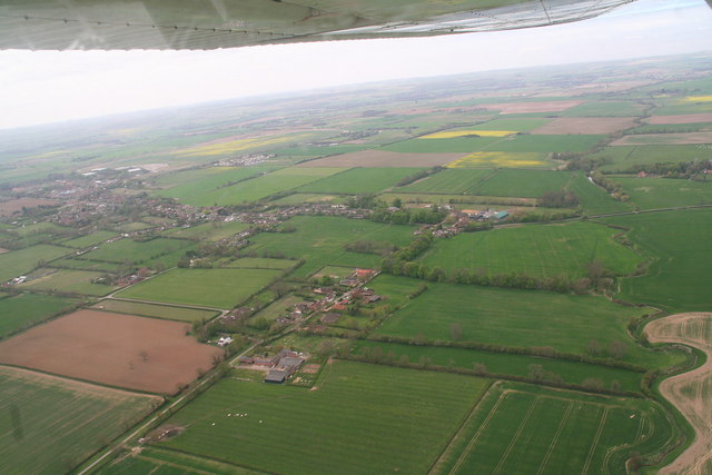
Image: © Chris Taken: 5 May 2013
Looking southwest from the Grayfleet Drain (right) to the old Manby airfield on the left. The road running from the bottom left corner is Pick Hill Lane, which becomes Northgate Lane when it reaches the white house (in the corner of the brown field). Running left from the white house is Middlesykes Lane.
Images are licensed for reuse under creativecommons.org/licenses/by-sa/2.0
Image Location
Latitude
53.372079
Longitude
0.089781