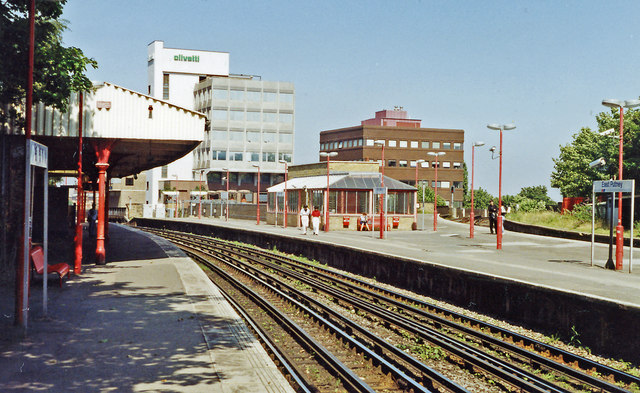
East Putney station, 1991
Introduction
The photograph on this page of East Putney station, 1991 by Ben Brooksbank as part of the Geograph project.
The Geograph project started in 2005 with the aim of publishing, organising and preserving representative images for every square kilometre of Great Britain, Ireland and the Isle of Man.
There are currently over 7.5m images from over 14,400 individuals and you can help contribute to the project by visiting https://www.geograph.org.uk

Image: © Ben Brooksbank Taken: 15 Aug 1991
View northward, LT District Line leftwards towards Central London and Upminster, also High Street Kensington and Edgware Road. Rightwards are the ex-LSWR lines to Clapham Junction and Waterloo: the platforms on that line were closed from 5/5/41 when the regular local services by that route ceased, but diverted through trains and especially empty stock used the loop, joining the Windsor Lines at Point Pleasant Junction; the Up line of this loop had just been closed (2/91) and the Down line resignalled for reversible working.

