East Ham station, 1991
Introduction
The photograph on this page of East Ham station, 1991 by Ben Brooksbank as part of the Geograph project.
The Geograph project started in 2005 with the aim of publishing, organising and preserving representative images for every square kilometre of Great Britain, Ireland and the Isle of Man.

There are currently over 7.5m images from over 14,400 individuals and you can help contribute to the project by visiting https://www.geograph.org.uk
East Ham station, 1991
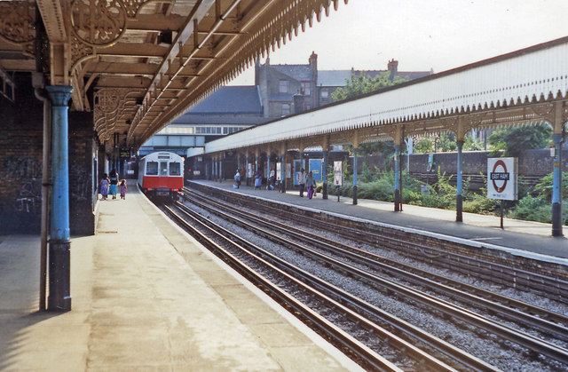
Image: © Ben Brooksbank Taken: 16 Aug 1991
View westward, towards London and Wimbledon, Ealing, Richmond on LT Underground District Line from Upminster, and Hammersmith via Baker Street on Metropolitan Line From Barking. The ex-Midland (LT&S) services to and from Fenchurch Street to Barking, Tilbury, Southend and Shoeburyness pass on tracks off camera to the left: none have called here since the route was electrified in June 1962 and the platforms are derelict. There were also steam trains from Kentish Town via Woodgrange Park until 15/9/58: these a bay platform on the right. (See also Image]).
Images are licensed for reuse under creativecommons.org/licenses/by-sa/2.0
Image Location
Latitude
51.539197
Longitude
0.051759