Whitmore Hall, Whitmore
Introduction
The photograph on this page of Whitmore Hall, Whitmore by Stephen Richards as part of the Geograph project.
The Geograph project started in 2005 with the aim of publishing, organising and preserving representative images for every square kilometre of Great Britain, Ireland and the Isle of Man.

There are currently over 7.5m images from over 14,400 individuals and you can help contribute to the project by visiting https://www.geograph.org.uk
Whitmore Hall, Whitmore
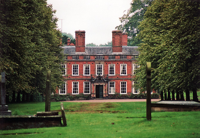
Image: © Stephen Richards Taken: 23 Aug 2002
Seen from the churchyard down an avenue of limes is this C16th house encased in red brick in 1676. The ornate porch dates from 1847. Massive moulded chimneystacks. Grade I listed.
Images are licensed for reuse under creativecommons.org/licenses/by-sa/2.0
Image Location


Leaflet Map data © OpenStreetMap
Latitude
52.968271
Longitude
-2.283157