Demolition site (2), High Street, Blackwood
Introduction
The photograph on this page of Demolition site (2), High Street, Blackwood by Jaggery as part of the Geograph project.
The Geograph project started in 2005 with the aim of publishing, organising and preserving representative images for every square kilometre of Great Britain, Ireland and the Isle of Man.

There are currently over 7.5m images from over 14,400 individuals and you can help contribute to the project by visiting https://www.geograph.org.uk
Demolition site (2), High Street, Blackwood
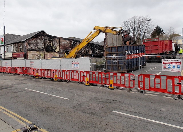
Image: © Jaggery Taken: 3 May 2013
The site is on the corner of High Street and Woodbine Road. In the early hours of May 1st 2013, a large fire severely damaged the Poundstretcher store. Dozens of firefighters tackled the blaze, which closed High Street. A large plume of smoke rose above the town. This view, taken 2 days later, shows that the Poundstretcher store has already been mostly demolished. It appears that the Timpson shoe shop on the left will also be demolished as a result of fire damage.
Images are licensed for reuse under creativecommons.org/licenses/by-sa/2.0
Image Location
Latitude
51.666674
Longitude
-3.195583