Bolina Road, blocked off
Introduction
The photograph on this page of Bolina Road, blocked off by Stephen Craven as part of the Geograph project.
The Geograph project started in 2005 with the aim of publishing, organising and preserving representative images for every square kilometre of Great Britain, Ireland and the Isle of Man.

There are currently over 7.5m images from over 14,400 individuals and you can help contribute to the project by visiting https://www.geograph.org.uk
Bolina Road, blocked off
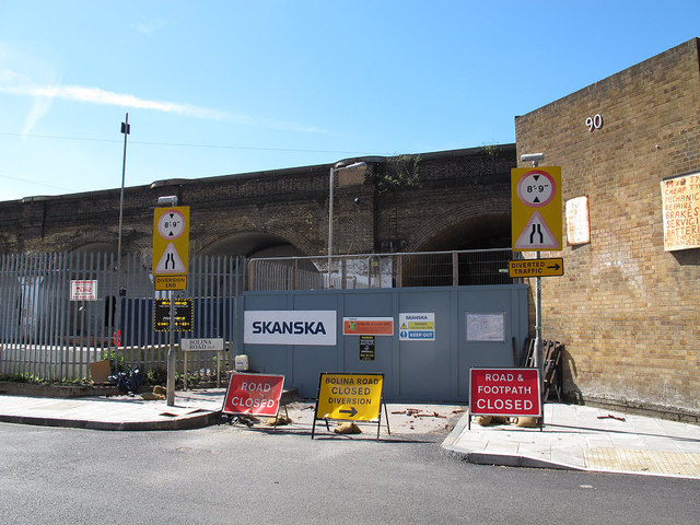
Image: © Stephen Craven Taken: 2 May 2013
Bolina Road was closed permanently at its northern end from 18 January 2013 for construction of new railway lines as part of the Thameslink project. The 8ft 9in height restriction shown applied to the lowest of the viaducts crossing the road, as shown in Image For the far end of the closed section, see Image
Images are licensed for reuse under creativecommons.org/licenses/by-sa/2.0
Image Location
Latitude
51.48815
Longitude
-0.050212