St Audries, West Quantoxhead
Introduction
The photograph on this page of St Audries, West Quantoxhead by Stephen Richards as part of the Geograph project.
The Geograph project started in 2005 with the aim of publishing, organising and preserving representative images for every square kilometre of Great Britain, Ireland and the Isle of Man.

There are currently over 7.5m images from over 14,400 individuals and you can help contribute to the project by visiting https://www.geograph.org.uk
St Audries, West Quantoxhead
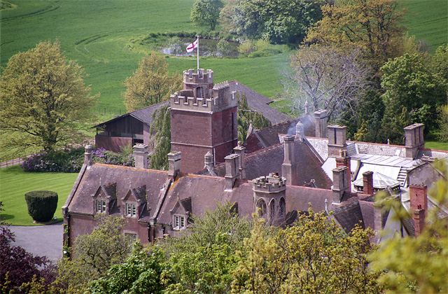
Image: © Stephen Richards Taken: 14 May 2004
I lied, just a view of bits of the roof, but Victorian roofscapes are never without interest. The house was built c1870 to the designs of John Norton. Grade II listed. Beyond is one of a series of ponds, possibly the "natural pond formed into a swimming bath in the mid or late C19" (English Heritage).
Images are licensed for reuse under creativecommons.org/licenses/by-sa/2.0
Image Location
Latitude
51.173086
Longitude
-3.273748