Marker at Lower Lliw reservoir
Introduction
The photograph on this page of Marker at Lower Lliw reservoir by john bristow as part of the Geograph project.
The Geograph project started in 2005 with the aim of publishing, organising and preserving representative images for every square kilometre of Great Britain, Ireland and the Isle of Man.

There are currently over 7.5m images from over 14,400 individuals and you can help contribute to the project by visiting https://www.geograph.org.uk
Marker at Lower Lliw reservoir
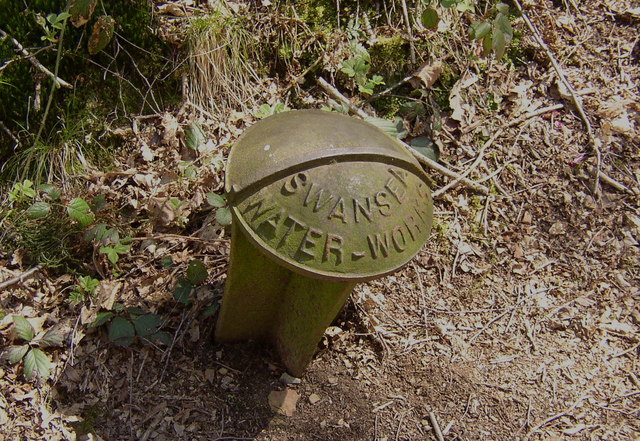
Image: © john bristow Taken: 2 May 2013
This looks like a boundary marker installed by Swansea Corporation Water Works when that Authority built the reservoir in the nineteenth century.
Images are licensed for reuse under creativecommons.org/licenses/by-sa/2.0
Image Location
Latitude
51.720955
Longitude
-3.949848