Site of former East Brixton station, 1991
Introduction
The photograph on this page of Site of former East Brixton station, 1991 by Ben Brooksbank as part of the Geograph project.
The Geograph project started in 2005 with the aim of publishing, organising and preserving representative images for every square kilometre of Great Britain, Ireland and the Isle of Man.

There are currently over 7.5m images from over 14,400 individuals and you can help contribute to the project by visiting https://www.geograph.org.uk
Site of former East Brixton station, 1991
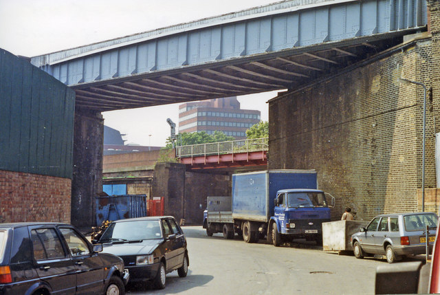
Image: © Ben Brooksbank Taken: 5 Jun 1991
View northward on Gresham Road, under the ex-LB&SC South London line (Victoria, (to left) - (to right) Peckham Rye - London Bridge) on which East Brixton station was situated (on the right) until closed 5/1/76. Beyond is the ex-SE&CR Victoria - Chatham - Ramsgate/Dover main line through Brixton station off to the left. (Cf. Image]).
Images are licensed for reuse under creativecommons.org/licenses/by-sa/2.0
Image Location
Latitude
51.463009
Longitude
-0.107429