Atlas Iron Works, Whitworth Road, Rochdale, Lancashire
Introduction
The photograph on this page of Atlas Iron Works, Whitworth Road, Rochdale, Lancashire by Dr Neil Clifton as part of the Geograph project.
The Geograph project started in 2005 with the aim of publishing, organising and preserving representative images for every square kilometre of Great Britain, Ireland and the Isle of Man.

There are currently over 7.5m images from over 14,400 individuals and you can help contribute to the project by visiting https://www.geograph.org.uk
Atlas Iron Works, Whitworth Road, Rochdale, Lancashire
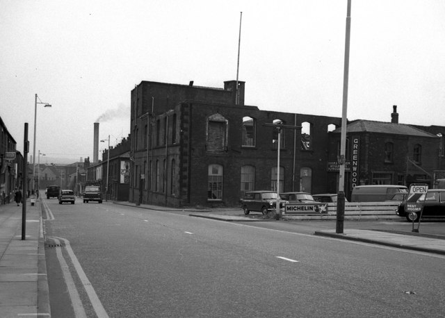
Image: © Dr Neil Clifton Taken: 30 Jul 1968
The demolition of this small iron foundry was completed very soon after this 1968 photograph was taken.
Images are licensed for reuse under creativecommons.org/licenses/by-sa/2.0
Image Location
Latitude
53.623335
Longitude
-2.155688