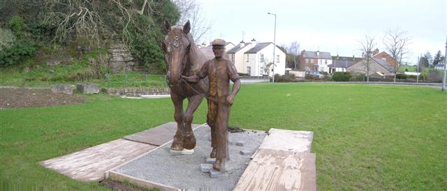
The Dromore ploughman
Introduction
The photograph on this page of The Dromore ploughman by Kenneth Allen as part of the Geograph project.
The Geograph project started in 2005 with the aim of publishing, organising and preserving representative images for every square kilometre of Great Britain, Ireland and the Isle of Man.
There are currently over 7.5m images from over 14,400 individuals and you can help contribute to the project by visiting https://www.geograph.org.uk

Image: © Kenneth Allen Taken: 20 Feb 2007
The new statue will be a feature of the dramatic glen which provides a scenic entrance to Dromore from the south west. On the escarpment above stand the proud remains of a church. This building was already old when the Plantation of Ulster maps showed it here in 1609. Repaired and taken over for Anglican use in the 1690s, Dromore Church was used until its abandonment in 1846. It retains a certain nobility even in its ruined state and more than one gullible traveller has been misled by local wits into taking it to be the fabled 'Castle of Dromore' of the haunting ballad. (The castle of that song is actually in County Cork.)

