The Bank
Introduction
The photograph on this page of The Bank by Thomas Nugent as part of the Geograph project.
The Geograph project started in 2005 with the aim of publishing, organising and preserving representative images for every square kilometre of Great Britain, Ireland and the Isle of Man.

There are currently over 7.5m images from over 14,400 individuals and you can help contribute to the project by visiting https://www.geograph.org.uk
The Bank
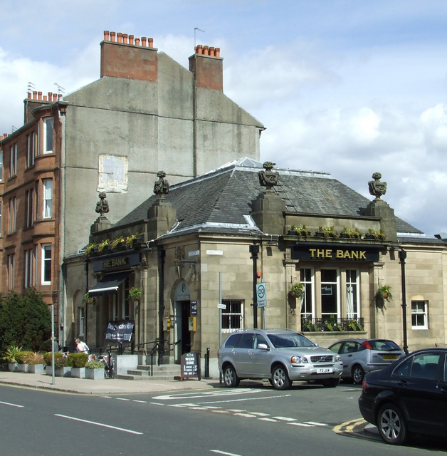
Image: © Thomas Nugent Taken: 27 Apr 2013
The former Savings Bank of Glasgow building (also former Muirend Savings Bank) at the corner of Clarkston Road and Gartly Street. The Category B Listed building became Muirend's first pub as recently as 2006. See also Image & Image Historic Scotland describes it as follows... Bank, built 1925-27 to designs of A N Paterson and Stoddart. Renaissance; tall single storey with steep slate roof and occupying corner site. Polished ashlar, contrasting granite detail and plinth. Symmetrical tripartite front to Clarkston Road, iron-balconied centre 3-light window in Doric 'in antis' frame, parapet over with sculpted vase finials; arched recesses in outer bays with prominent key-stones (door to right, sculptured crest over); flank elevation to Gartly Street is a simplified version of the same composition. INTERIOR: large banking hall, coffered ceiling with elliptical centre cupola, original full-width counter and partition along north (rear) wall. "The Savings bank of Glasgow" sign placed on gable of tenement adjoining (437 Clarkston Road) is presumably also the work of Paterson and Stoddart.
Images are licensed for reuse under creativecommons.org/licenses/by-sa/2.0
Image Location
Latitude
55.810108
Longitude
-4.270791