Waymark, Thame Park
Introduction
The photograph on this page of Waymark, Thame Park by Des Blenkinsopp as part of the Geograph project.
The Geograph project started in 2005 with the aim of publishing, organising and preserving representative images for every square kilometre of Great Britain, Ireland and the Isle of Man.

There are currently over 7.5m images from over 14,400 individuals and you can help contribute to the project by visiting https://www.geograph.org.uk
Waymark, Thame Park
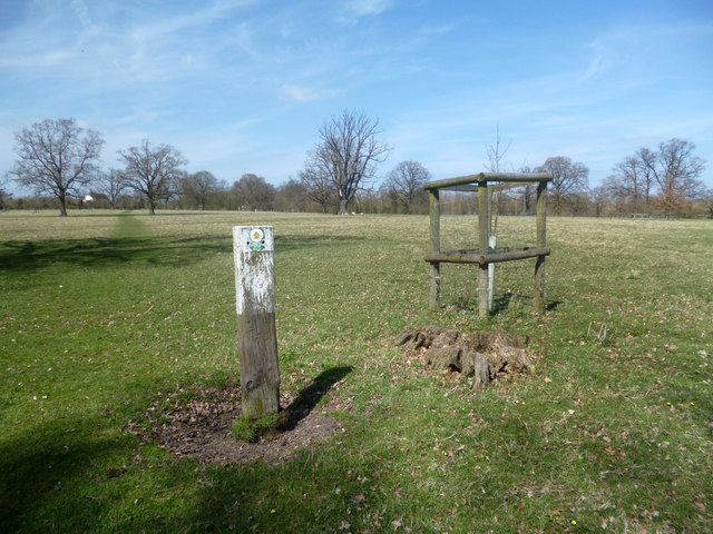
Image: © Des Blenkinsopp Taken: 23 Apr 2013
The footpath in Thame Park is straight as a Roman road, and very easy to follow. Even so, these stout marker posts have been put up at intervals, just in case you were thinking of wandering off. Thame Park is thought to be some of the oldest enclosed parkland in England. Some new tree planting has been done recently as you see here, with a new sapling, well protected against the animals that graze the park, growing up near the stump of its predecessor.
Images are licensed for reuse under creativecommons.org/licenses/by-sa/2.0
Image Location
Latitude
51.731752
Longitude
-0.972749