Welsh Air Ambulance charity shop, Pontypridd
Introduction
The photograph on this page of Welsh Air Ambulance charity shop, Pontypridd by Jaggery as part of the Geograph project.
The Geograph project started in 2005 with the aim of publishing, organising and preserving representative images for every square kilometre of Great Britain, Ireland and the Isle of Man.

There are currently over 7.5m images from over 14,400 individuals and you can help contribute to the project by visiting https://www.geograph.org.uk
Welsh Air Ambulance charity shop, Pontypridd
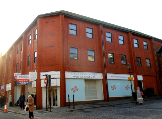
Image: © Jaggery Taken: 12 Jan 2012
The charity shop is at 5 Taff Street. The sale of donated items here, such as furniture, bric-a-brac, books and toys, provides funds for Wales Air Ambulance, an all-Wales charity providing a vital service through emergency air cover for those who face life-threatening illness or injuries. Three helicopters are on active duty 365 days a year. They are needed because of the widely-scattered population and diverse landscape in Wales, where many people live in isolated locations far from an accident and emergency service. Also, the ever increasing problem of traffic congestion and collisions in more urban areas can lead to delayed response times for road ambulances. There is a helicopter landing pad http://www.geograph.org.uk/photo/2341553 adjacent to the Accident and Emergency unit at the University Hospital of Wales, Cardiff.
Images are licensed for reuse under creativecommons.org/licenses/by-sa/2.0
Image Location
Latitude
51.601532
Longitude
-3.340861