Pleasley NG19, Near Mansfield, Notts.
Introduction
The photograph on this page of Pleasley NG19, Near Mansfield, Notts. by David Hallam-Jones as part of the Geograph project.
The Geograph project started in 2005 with the aim of publishing, organising and preserving representative images for every square kilometre of Great Britain, Ireland and the Isle of Man.

There are currently over 7.5m images from over 14,400 individuals and you can help contribute to the project by visiting https://www.geograph.org.uk
Pleasley NG19, Near Mansfield, Notts.
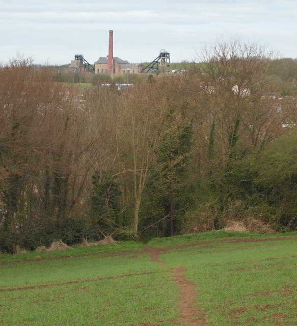
Image: © David Hallam-Jones Taken: 28 Apr 2013
This footpath continues into the copse ahead and very quickly links to the top of a flight of steps descending down an embankment to reach the side of the A617 Road (Chesterfield Road North), opposite the junction with the 'old' Chesterfield Road junction and The White Swan pub. Behind the photographer the footpath continues across the ploughed field and a couple of minutes later it joins a track that connects the Pleasley end of Woburn Lane, Pleasley Hill with a private residence called Radmanthwaite Cottage at the termination of the lane. This arable land seems likely to belong to Wren Hill Farm, Lower Radmanthwaite. The name Radmanthwaite is derived from two words, a radman being a tenant owing his lord the duty of an armed escort + thwaite being a clearing in a wood or land reclaimed for arable purposes. In the distance is the former Pleasley Colliery that ceased to produce coal in the 1980s.
Images are licensed for reuse under creativecommons.org/licenses/by-sa/2.0
Image Location
Latitude
53.172856
Longitude
-1.24177