Townhead of Aber
Introduction
The photograph on this page of Townhead of Aber by Lairich Rig as part of the Geograph project.
The Geograph project started in 2005 with the aim of publishing, organising and preserving representative images for every square kilometre of Great Britain, Ireland and the Isle of Man.

There are currently over 7.5m images from over 14,400 individuals and you can help contribute to the project by visiting https://www.geograph.org.uk
Townhead of Aber
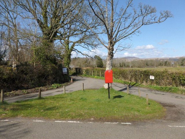
Image: © Lairich Rig Taken: 19 Apr 2013
In his booklet "Off the Main Road" (1976), I M M MacPhail wrote about the Townhead of Aber, and its pillar-box, which seemed "quaintly out of place in its rural setting". It presumably stood here, where there is now a more modest postbox. MacPhail also notes that few houses in Aber are contiguous with one another, but that the Townhead was regarded as a central point. The name Townhead of Aber can be seen on the first-edition OS map (surveyed in 1860), and appears on subsequent OS maps until around 1960. See also Image, where part of the same area is visible in the left foreground. That item also comments on the name Aber itself.
Images are licensed for reuse under creativecommons.org/licenses/by-sa/2.0
Image Location
Latitude
56.051118
Longitude
-4.530977