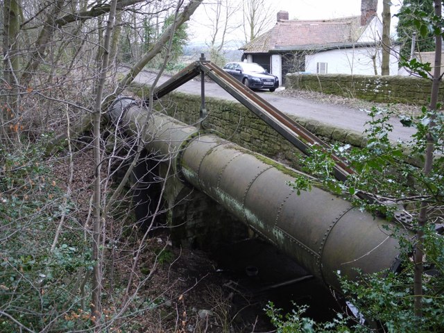
Pipeline of Throckley Aqueduct, Heddon Banks
Introduction
The photograph on this page of Pipeline of Throckley Aqueduct, Heddon Banks by Andrew Curtis as part of the Geograph project.
The Geograph project started in 2005 with the aim of publishing, organising and preserving representative images for every square kilometre of Great Britain, Ireland and the Isle of Man.
There are currently over 7.5m images from over 14,400 individuals and you can help contribute to the project by visiting https://www.geograph.org.uk

Image: © Andrew Curtis Taken: 21 Feb 2013
The 42" cast-iron pipe supported on iron columns runs alongside the bridge that takes the track running from the end of Heddon Banks to Close Lea over the cutting of the former tramway used to take stone from Killiebrigs Quarry. The house opposite is called West Acres. There is another photo of the pipe here Image Although the pipeline roughly follows the line of the track to the east (left), this is not the case to the west (right). There is actually a right-angled bend close to the right side of the photo where the pipe, close to the ground surface follows the boundary of the quarry, then bends again to continue its course across the lower part of the now-wooded Heddon Common. The iron pipe-line was completed in 1892 replacing earthenware pipes first laid in 1869 and the indication here is that the previous line was altered to cope with opening of the Quarry and its tramway around 1878.

