Gabbro outcrop
Introduction
The photograph on this page of Gabbro outcrop by Jonathan Wilkins as part of the Geograph project.
The Geograph project started in 2005 with the aim of publishing, organising and preserving representative images for every square kilometre of Great Britain, Ireland and the Isle of Man.

There are currently over 7.5m images from over 14,400 individuals and you can help contribute to the project by visiting https://www.geograph.org.uk
Gabbro outcrop
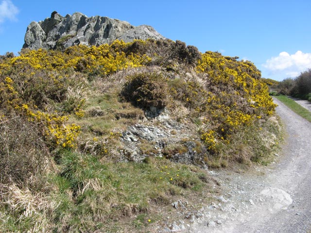
Image: © Jonathan Wilkins Taken: 26 Apr 2013
Certain rock outcrops in the Precambrian of Anglesey are highly enigmatic, notwithstanding their great interest. This rock is what remains of a quarry in a serpentinised gabbro exposure - the interest arising from the idea that magnesium-rich rocks originating as ophiolite, or ocean-floor basalts, have been emplaced during the subduction of the Iapetus Ocean and subsequent continental collision. This view is not held by everybody who has worked on the local geology. A footpath runs along this track, which gives access to a number of houses towards the coast.
Images are licensed for reuse under creativecommons.org/licenses/by-sa/2.0
Image Location
Latitude
53.263257
Longitude
-4.59858