Mortlake: Former 'Queen's Arms'
Introduction
The photograph on this page of Mortlake: Former 'Queen's Arms' by Dr Neil Clifton as part of the Geograph project.
The Geograph project started in 2005 with the aim of publishing, organising and preserving representative images for every square kilometre of Great Britain, Ireland and the Isle of Man.

There are currently over 7.5m images from over 14,400 individuals and you can help contribute to the project by visiting https://www.geograph.org.uk
Mortlake: Former 'Queen's Arms'
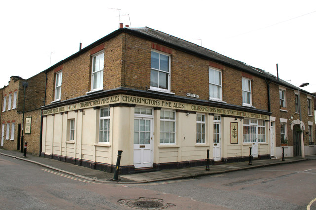
Image: © Dr Neil Clifton Taken: 24 Apr 2013
Not a pub now and it has probably been converted to houses for some time, but the original signage has, sensibly, been kept and is well maintained. Charrington's Brewery in the City was taken over by Whitbread in the early fifties, but they maintained the 'Charrington's IPA' name for some years.
Images are licensed for reuse under creativecommons.org/licenses/by-sa/2.0
Image Location
Latitude
51.46654
Longitude
-0.259894