Site of former Dunning station, 1991
Introduction
The photograph on this page of Site of former Dunning station, 1991 by Ben Brooksbank as part of the Geograph project.
The Geograph project started in 2005 with the aim of publishing, organising and preserving representative images for every square kilometre of Great Britain, Ireland and the Isle of Man.

There are currently over 7.5m images from over 14,400 individuals and you can help contribute to the project by visiting https://www.geograph.org.uk
Site of former Dunning station, 1991
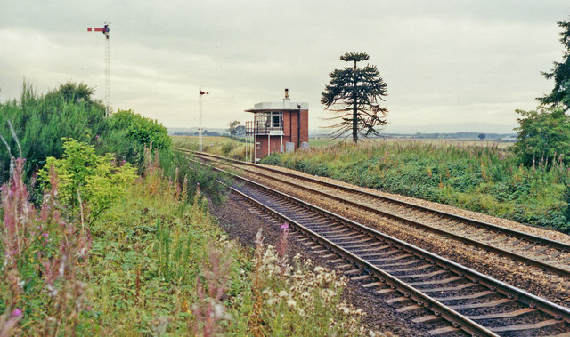
Image: © Ben Brooksbank Taken: 5 Sep 1991
View Sw, towards Stirling and Glasgow: ex-Caledonian Railway Glasgow - Stirling - Perth etc. main line. The station, which was about two miles from Dunning, had been closed to passengers 11/6/56, to goods 7/9/64 - but a new signalbox seems to be provided.
Images are licensed for reuse under creativecommons.org/licenses/by-sa/2.0
Image Location
Latitude
56.330918
Longitude
-3.611427