NE side of a small railway bridge, Pontlottyn
Introduction
The photograph on this page of NE side of a small railway bridge, Pontlottyn by Jaggery as part of the Geograph project.
The Geograph project started in 2005 with the aim of publishing, organising and preserving representative images for every square kilometre of Great Britain, Ireland and the Isle of Man.

There are currently over 7.5m images from over 14,400 individuals and you can help contribute to the project by visiting https://www.geograph.org.uk
NE side of a small railway bridge, Pontlottyn
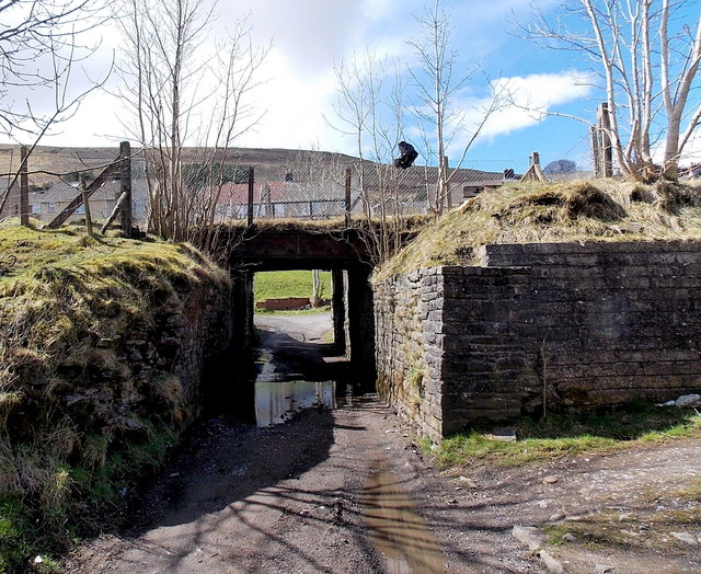
Image: © Jaggery Taken: 19 Apr 2013
Viewed from the access lane from Tynewydd Farm. The road under the bridge leads to Heol-y-waun and the A469 in Pontlottyn. The railway is part of the single-track section of the Rhymney Line, about 550 metres SSE of Pontlottyn station. http://www.geograph.org.uk/photo/3419166 The masonry in front of the bridge, on both sides of the lane, is a remnant of an earlier bridge, at a time when the line was double track.
Images are licensed for reuse under creativecommons.org/licenses/by-sa/2.0
Image Location
Latitude
51.742443
Longitude
-3.275361