Site of Dukeries Junction (High Level) station, 1992
Introduction
The photograph on this page of Site of Dukeries Junction (High Level) station, 1992 by Ben Brooksbank as part of the Geograph project.
The Geograph project started in 2005 with the aim of publishing, organising and preserving representative images for every square kilometre of Great Britain, Ireland and the Isle of Man.

There are currently over 7.5m images from over 14,400 individuals and you can help contribute to the project by visiting https://www.geograph.org.uk
Site of Dukeries Junction (High Level) station, 1992
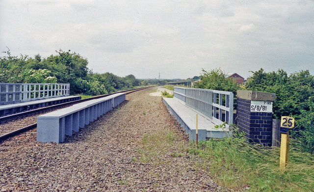
Image: © Ben Brooksbank Taken: 18 Jun 1992
View westward, towards Shirebrook/Langwith and Chesterfield: ex-GCR (Lancashire, Derbyshire & East Coast line), Chesterfield - Shirebrook North - Lincoln. This station was never a Junction, but was a little-used dual (High Level/Low Level) interchange station between the LD&EC and the East Coast Main Line (ex-Great Northern) below. Hardly any trains on either line ever stopped here and the station(s) were closed 6/3/50. The LD&ECR was closed Chesterfield - Shirebrook North to passengers 1/12/51, to goods 4/3/57: Shirebrook North - Lincoln to passengers 19/9/55, to goods 30/3/64, but remained open until 2003 from Shirebrook/Langwith Junction for merry-go-round coal trains for High Marnham Power Station near Clifton-on-Trent. From 10/7/09 this stretch, between Thoresby Colliery Junction and High Marnham, has been restored as the High Marnham Test Track.
Images are licensed for reuse under creativecommons.org/licenses/by-sa/2.0
Image Location
Latitude
53.22535
Longitude
-0.876852