Burnstones Viaduct (west side)
Introduction
The photograph on this page of Burnstones Viaduct (west side) by Mike Quinn as part of the Geograph project.
The Geograph project started in 2005 with the aim of publishing, organising and preserving representative images for every square kilometre of Great Britain, Ireland and the Isle of Man.

There are currently over 7.5m images from over 14,400 individuals and you can help contribute to the project by visiting https://www.geograph.org.uk
Burnstones Viaduct (west side)
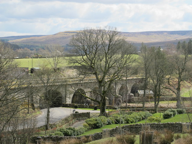
Image: © Mike Quinn Taken: 19 Apr 2013
Burnstones Viaduct carried the Haltwhistle to Alston branch line across the A689, Thinhope Burn and a sike draining the rough pastures west of Side House. For info about the branch line, see https://www.south-tynedale-railway.org.uk . The geometry of the viaduct is unusual (possibly unique) in that the road arch is skewed one way to the line of the (former) railway , and the four arches that cross Thinhope Burn are skewed the other way - see the satellite image http://maps.google.co.uk/maps?q=Knaresdale+with+Kirkhaugh&hl=en&ll=54.88279,-2.50738&spn=0.001106,0.002438&sll=54.812167,-2.438685&sspn=0.035463,0.07802&oq=knaresdale&hnear=Knaresdale+with+Kirkhaugh,+Northumberland,+United+Kingdom&t=k&z=19 . The builders of the bridge overcame this civil engineering problem by means of a deep blind arch between the road arch and the northernmost of the open arches that cross the burn. So the viaduct appears to have six arches on the west side (the road arch, the blind arch and four open arches over the burn) and only five (all open arches) on the east side. For more information about the viaduct, see http://ds.dial.pipex.com/town/lane/jy40/page47.html. See also Image, Image, Image, Image and Image
Images are licensed for reuse under creativecommons.org/licenses/by-sa/2.0
Image Location
Latitude
54.88284
Longitude
-2.507635