Eastward view
Introduction
The photograph on this page of Eastward view by Dai Bevan as part of the Geograph project.
The Geograph project started in 2005 with the aim of publishing, organising and preserving representative images for every square kilometre of Great Britain, Ireland and the Isle of Man.

There are currently over 7.5m images from over 14,400 individuals and you can help contribute to the project by visiting https://www.geograph.org.uk
Eastward view
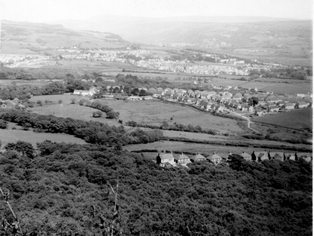
Image: © Dai Bevan Taken: Unknown
This view scanned from a print taken in the 1960s, shows in the foreground, Darran Woods and the row of houses at Penshanel. The fields between there and the village of Longford (centre of picture) have now been built on. Beyond Longford is Taillwyd, where the fields have again been replaced by houses. Towards the top centre of the picture is the Village of Caewern, and in the background the Neath Valley runs between the two sets of hills.
Images are licensed for reuse under creativecommons.org/licenses/by-sa/2.0
Image Location
Latitude
51.669918
Longitude
-3.83008