Manor Farm Bagber
Introduction
The photograph on this page of Manor Farm Bagber by Nigel Mykura as part of the Geograph project.
The Geograph project started in 2005 with the aim of publishing, organising and preserving representative images for every square kilometre of Great Britain, Ireland and the Isle of Man.

There are currently over 7.5m images from over 14,400 individuals and you can help contribute to the project by visiting https://www.geograph.org.uk
Manor Farm Bagber
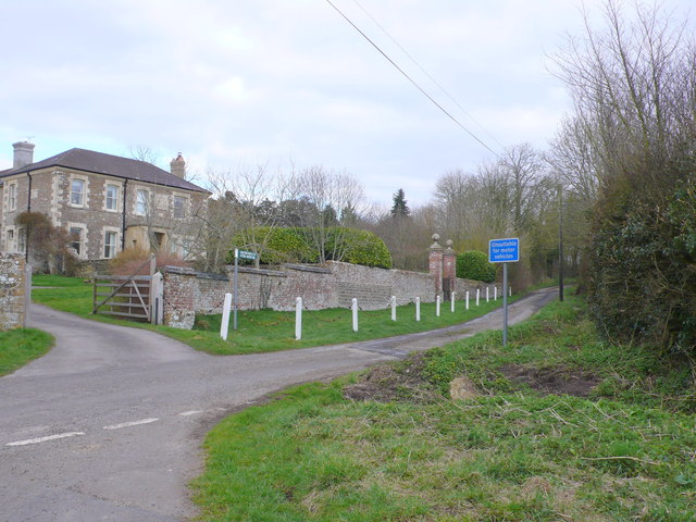
Image: © Nigel Mykura Taken: 29 Mar 2013
This is a substantial old farm and on the left can be seen the main house. The road on the right is an " Other Route with Public Access" ORPA and is signposted as a "Halter Path" on the sign next to the gateway. It leads to Sturminster Newton Mill and is called Stalbridge Lane.
Images are licensed for reuse under creativecommons.org/licenses/by-sa/2.0
Image Location
Latitude
50.938924
Longitude
-2.330703