Derelict Snowdown Working Men's Club
Introduction
The photograph on this page of Derelict Snowdown Working Men's Club by Marathon as part of the Geograph project.
The Geograph project started in 2005 with the aim of publishing, organising and preserving representative images for every square kilometre of Great Britain, Ireland and the Isle of Man.

There are currently over 7.5m images from over 14,400 individuals and you can help contribute to the project by visiting https://www.geograph.org.uk
Derelict Snowdown Working Men's Club
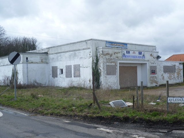
Image: © Marathon Taken: 12 Apr 2013
Snowdown was the deepest of the four main pits in the Kent Coalfield, - see http://en.wikipedia.org/wiki/Kent_Coalfield , reaching a depth of 3,083 feet. Work commenced in 1908, and coal was first brought to the surface on November 19th 1912. The first shaft sunk hit water at 260 feet and 22 men were drowned. The colliery was served by the Faversham to Dover railway, and a halt called Snowdown & Nonington was provided. The new town of Aylesham was built just to the north of the colliery to provide homes for the many migrant workers from Wales and the north-east of England. In 1945 the workforce was 1,876, with 1,523 being employed sub-surface and 353 above. The colliery closed in 1986 and the shafts were capped in 1988. Just on the other side of the station from the former colliery was Snowdown Working Men's Club. Like so much else in this immediate area it has seen better days. Update:- by 2020 it had gone and been replaced by new houses but the old colliery across the road was still there - see www.geograph.org.uk/photo/3413529
Images are licensed for reuse under creativecommons.org/licenses/by-sa/2.0
Image Location
Latitude
51.215316
Longitude
1.212747