Kidston Park
Introduction
The photograph on this page of Kidston Park by Lairich Rig as part of the Geograph project.
The Geograph project started in 2005 with the aim of publishing, organising and preserving representative images for every square kilometre of Great Britain, Ireland and the Isle of Man.

There are currently over 7.5m images from over 14,400 individuals and you can help contribute to the project by visiting https://www.geograph.org.uk
Kidston Park
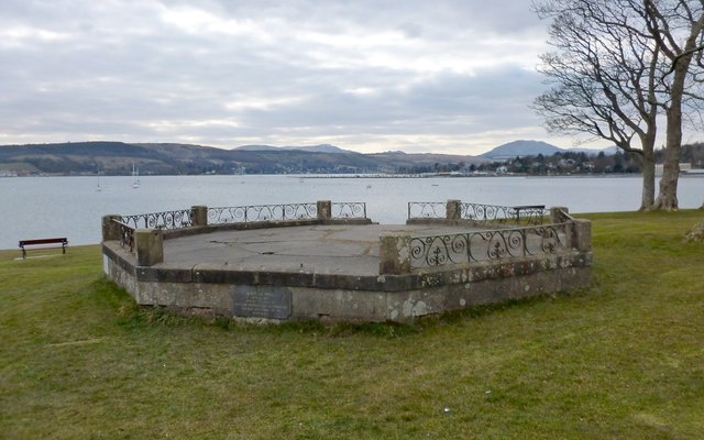
Image: © Lairich Rig Taken: 2 Apr 2013
The structure shown here was, before its whole upper part was removed, a bandstand. For later views in sunlight, see Image and Image The park is on Image, which was once popularly known as Neddy's Point, after the Duke of Argyll's fisherman (see the footnote on page 111 of W C Maughan's 1897 "Annals of Garelochside"; page 12 of Donald MacLeod's 1883 book "Garelochside and Helensburgh" gives further anecdotal details about Neddy). For the plaque that can be seen on the near side of the former bandstand, and for links to information about William Kidston of Ferniegair, after whom the park is named, see Image The prominent background hill above the right-hand end of the former bandstand is Creachan Mòr (Image).
Images are licensed for reuse under creativecommons.org/licenses/by-sa/2.0
Image Location
Latitude
56.008249
Longitude
-4.76112