
Lancaster Canal Feeder from Peasey Beck
Introduction
The photograph on this page of Lancaster Canal Feeder from Peasey Beck by Martin Stockdale as part of the Geograph project.
The Geograph project started in 2005 with the aim of publishing, organising and preserving representative images for every square kilometre of Great Britain, Ireland and the Isle of Man.

There are currently over 7.5m images from over 14,400 individuals and you can help contribute to the project by visiting https://www.geograph.org.uk
Lancaster Canal Feeder from Peasey Beck
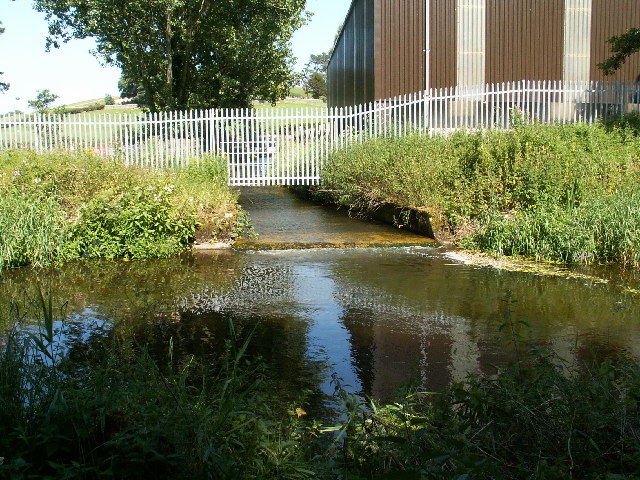
Image: © Martin Stockdale Taken: 16 Jul 2005
Many people assume that canals are like large ponds and that the water does not flow. In fact, canals were built like an artificial river, and have a natural 'flow' of water along them. One of the important design considerations when a canal was being built was the supply of water. One of the main sources of water for the Lancaster Canal is Killington reservoir (SD5891) which will be familiar to anybody stopping at the M6 services near Junction 37. The reservoir was built specifically to feed the canal, and the water from it flows about 15km along Killington Beck and Peasey Beck before being diverted into the canal here. Because this feeder is north of where the canal was blocked to build the M6, the water had to be culverted under the motorway to feed the rest of the canal. As a result, this stretch is still in water but is not navigable from the rest of the canal.
Images are licensed for reuse under creativecommons.org/licenses/by-sa/2.0
Image Location

Latitude
54.245064
Longitude
-2.71507