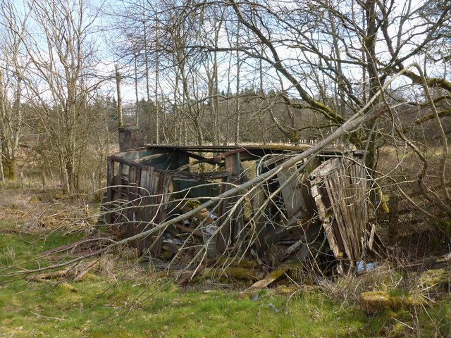
Trackside hut
Introduction
The photograph on this page of Trackside hut by Lairich Rig as part of the Geograph project.
The Geograph project started in 2005 with the aim of publishing, organising and preserving representative images for every square kilometre of Great Britain, Ireland and the Isle of Man.
There are currently over 7.5m images from over 14,400 individuals and you can help contribute to the project by visiting https://www.geograph.org.uk

Image: © Lairich Rig Taken: 1 Apr 2013
The ruin is also depicted in another contributor's earlier photograph: Image In the present picture, it appears to be near its final collapse (for which, see Image, taken in 2019). It is located beside Image, on the course of the dismantled railway line (see the end-note). Unlikely though it might now seem, this former Forth and Clyde Junction Railway parcels van used as to be somebody's home; the chimney that can be seen built onto the hut is an addition made in that period. See Image for further details. Page 102 of the book that is cited there includes two photographs of the hut.
Image Location


