Ruins of the former British Ironworks offices and foundry, Abersychan
Introduction
The photograph on this page of Ruins of the former British Ironworks offices and foundry, Abersychan by Jaggery as part of the Geograph project.
The Geograph project started in 2005 with the aim of publishing, organising and preserving representative images for every square kilometre of Great Britain, Ireland and the Isle of Man.

There are currently over 7.5m images from over 14,400 individuals and you can help contribute to the project by visiting https://www.geograph.org.uk
Ruins of the former British Ironworks offices and foundry, Abersychan
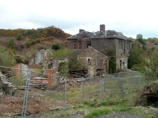
Image: © Jaggery Taken: 16 Apr 2011
These ruins occupy a quadrangle roughly 40 metres by 40 metres. The ironworks, on land to the west of Abersychan, were established in 1826, originally named Abersychan Ironworks. The newly-formed British Iron Company took over the works in 1829. The upsurge in demand for steel from about 1870 caused a decline in the demand for iron, so much so that the ironworks closed down in 1876. Various fragments of the works remain. As well as these buildings, there are the remains of a former pumping engine house http://www.geograph.org.uk/photo/3409387 about 100 metres away.
Images are licensed for reuse under creativecommons.org/licenses/by-sa/2.0
Image Location
Latitude
51.726358
Longitude
-3.07684