Great St Helen's Street, London, EC3
Introduction
The photograph on this page of Great St Helen's Street, London, EC3 by David Hallam-Jones as part of the Geograph project.
The Geograph project started in 2005 with the aim of publishing, organising and preserving representative images for every square kilometre of Great Britain, Ireland and the Isle of Man.

There are currently over 7.5m images from over 14,400 individuals and you can help contribute to the project by visiting https://www.geograph.org.uk
Great St Helen's Street, London, EC3
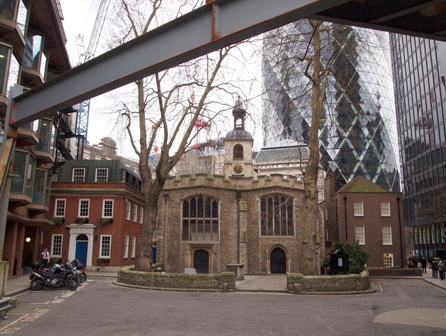
Image: © David Hallam-Jones Taken: 5 Apr 2013
Old and newer buildings in Great St Helen's Street glimpsed from beneath a girder associated with the building of the neighbouring "Pinnancle" tower block. The Grade II-listed 12th century Church of "St Helen's, Bishopsgate" occupies the centre space. This was William Shakespeare's parish church when he lived in the area in the 1590s. It was one of a few City churches to survive the Great Fire of London of 1666 and the World War II blitz. Two separate IRA bomb explosions nearby in 1992 and 1993 however, did considerable damage. Also visible is 30, St Mary Axe (a.k.a. "The Gherkin") that was opened at the end of May 2004 on the site of the former Baltic Exchange, that was badly damaged by a Provisional IRA bomb explosion in 1992.
Images are licensed for reuse under creativecommons.org/licenses/by-sa/2.0
Image Location
Latitude
51.514763
Longitude
-0.082657