View down to Centre for World Peace and Health
Introduction
The photograph on this page of View down to Centre for World Peace and Health by Rob Farrow as part of the Geograph project.
The Geograph project started in 2005 with the aim of publishing, organising and preserving representative images for every square kilometre of Great Britain, Ireland and the Isle of Man.

There are currently over 7.5m images from over 14,400 individuals and you can help contribute to the project by visiting https://www.geograph.org.uk
View down to Centre for World Peace and Health
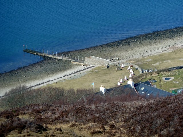
Image: © Rob Farrow Taken: 5 Apr 2013
The Buddhist Centre for World Peace and Health on Holy Island off Arran is adjacent to the jetty where the little ferry from Lamlash docks. The Buddhist community here have several other retreats around the island. See http://holyisle.org/index This view is from the slopes of Mullach Beag on the path across the top of the island. Note how the wavelets on the sea are running perpendicular to the island's coast rather than breaking parallel to it, this was because there was so little wind and that which there was, was pushing the water between Holy Island and its larger neighbour, Arran, through the channel between them. Later the sea became glassy calm with no breath of wind - see Image]
Images are licensed for reuse under creativecommons.org/licenses/by-sa/2.0
Image Location
Latitude
55.533302
Longitude
-5.087528