Site of former Darfield station
Introduction
The photograph on this page of Site of former Darfield station by Ben Brooksbank as part of the Geograph project.
The Geograph project started in 2005 with the aim of publishing, organising and preserving representative images for every square kilometre of Great Britain, Ireland and the Isle of Man.

There are currently over 7.5m images from over 14,400 individuals and you can help contribute to the project by visiting https://www.geograph.org.uk
Site of former Darfield station
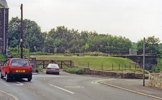
Image: © Ben Brooksbank Taken: 21 Jun 1992
View SW, across the site of the station and the disused ex-Midland four-track main line from Sheffield and Rotherham (to left) to Normanton and Leeds (to right). The station was closed 17/6/63, while from 1/1/68 all passenger trains were diverted off the route between Wath Road Junction and Goose Hill Junction (Normanton) owing to colliery subsidences, although freight trains were still worked over it for several more years.
Images are licensed for reuse under creativecommons.org/licenses/by-sa/2.0
Image Location
Latitude
53.535365
Longitude
-1.363107