Byway to Gronant
Introduction
The photograph on this page of Byway to Gronant by Maggie Cox as part of the Geograph project.
The Geograph project started in 2005 with the aim of publishing, organising and preserving representative images for every square kilometre of Great Britain, Ireland and the Isle of Man.

There are currently over 7.5m images from over 14,400 individuals and you can help contribute to the project by visiting https://www.geograph.org.uk
Byway to Gronant
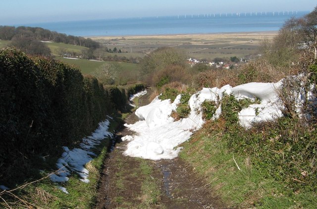
Image: © Maggie Cox Taken: 3 Apr 2013
Down the hill you can see Gronant. On the hillside to the left is Coed Bell Wood to the right of which, down on the flat, you can just see a train on the Chester to Holyhead railway. In the far distance you can see a windfarm offshore.
Images are licensed for reuse under creativecommons.org/licenses/by-sa/2.0
Image Location
Latitude
53.332738
Longitude
-3.359103