Record flood levels at the Boat Inn
Introduction
The photograph on this page of Record flood levels at the Boat Inn by John M as part of the Geograph project.
The Geograph project started in 2005 with the aim of publishing, organising and preserving representative images for every square kilometre of Great Britain, Ireland and the Isle of Man.

There are currently over 7.5m images from over 14,400 individuals and you can help contribute to the project by visiting https://www.geograph.org.uk
Record flood levels at the Boat Inn
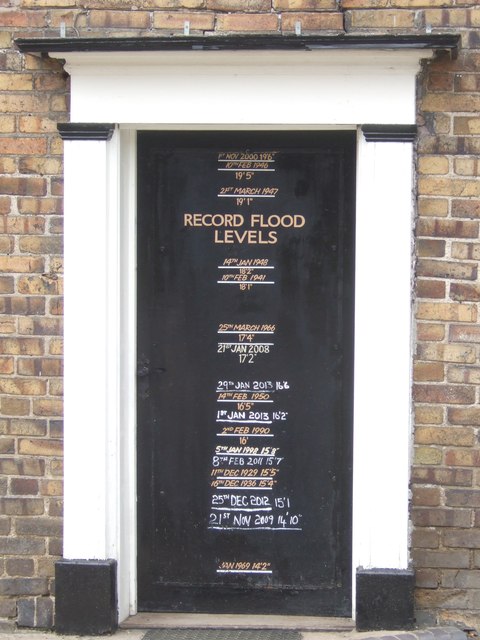
Image: © John M Taken: 7 Apr 2013
Record flood levels are painted onto the doorway of the Boat Inn Image Levels on the River Severn rose to 16'6" on the 29th January 2013.
Images are licensed for reuse under creativecommons.org/licenses/by-sa/2.0
Image Location
Latitude
52.619394
Longitude
-2.454604