Urban regeneration at Blakenhall Gardens, Wolverhampton
Introduction
The photograph on this page of Urban regeneration at Blakenhall Gardens, Wolverhampton by Roger D Kidd as part of the Geograph project.
The Geograph project started in 2005 with the aim of publishing, organising and preserving representative images for every square kilometre of Great Britain, Ireland and the Isle of Man.

There are currently over 7.5m images from over 14,400 individuals and you can help contribute to the project by visiting https://www.geograph.org.uk
Urban regeneration at Blakenhall Gardens, Wolverhampton
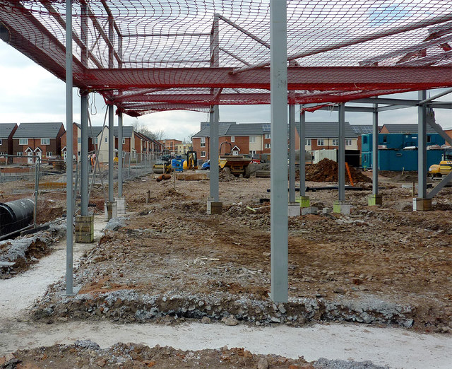
Image: © Roger D Kidd Taken: 5 Apr 2013
Work is well under way in this project. This view from Dudley Road (near Byrne Road) looks through the framework over which new shops will be built. Update - April 2014: the whole project has been completed - looks very smart, including two excellent Asian supermarkets, and some smaller shops.
Images are licensed for reuse under creativecommons.org/licenses/by-sa/2.0
Image Location
Latitude
52.571745
Longitude
-2.12611