Blue plaque marking the location of the demolished Royalty Theatre, Llanelli
Introduction
The photograph on this page of Blue plaque marking the location of the demolished Royalty Theatre, Llanelli by Jaggery as part of the Geograph project.
The Geograph project started in 2005 with the aim of publishing, organising and preserving representative images for every square kilometre of Great Britain, Ireland and the Isle of Man.

There are currently over 7.5m images from over 14,400 individuals and you can help contribute to the project by visiting https://www.geograph.org.uk
Blue plaque marking the location of the demolished Royalty Theatre, Llanelli
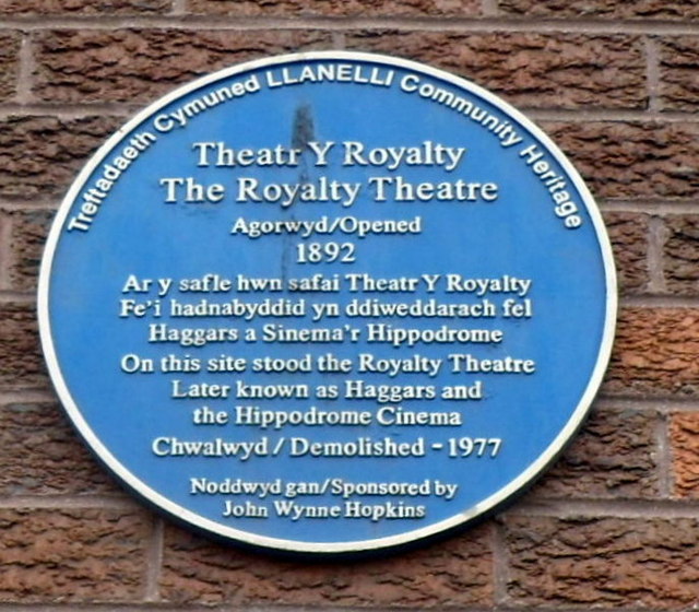
Image: © Jaggery Taken: 8 Apr 2012
The Llanelli Community Heritage plaque is on the wall on this http://www.geograph.org.uk/photo/3397861 building. It records that the Royalty Theatre stood on this site from 1892. It was later known as Haggars and the Hippodrome Cinema. Demolished in 1977.
Images are licensed for reuse under creativecommons.org/licenses/by-sa/2.0
Image Location
Latitude
51.683381
Longitude
-4.159731