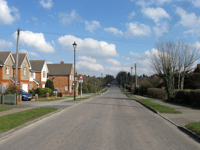
London Road
Introduction
The photograph on this page of London Road by Simon Carey as part of the Geograph project.
The Geograph project started in 2005 with the aim of publishing, organising and preserving representative images for every square kilometre of Great Britain, Ireland and the Isle of Man.
There are currently over 7.5m images from over 14,400 individuals and you can help contribute to the project by visiting https://www.geograph.org.uk

Image: © Simon Carey Taken: 2 Apr 2013
The straight nature of the road is due to its course being marked out when the former Ashington Common, which it crossed, was enclosed in 1816. From that enclosure comes the origins of the modern village of Ashington which eventually built itself up around it, despite this part actually being in the parish of Washington until 1960. An important route in the age of coaching it retained this during the age of the motor car becoming the A24 which for many years was clogged by traffic until the construction of the bypass in the mid 1990s finally bought peace to the centre of the village. The houses on the left are Forge House, The Smithy and Anvil House built on the site of the former village blacksmith. The older dwellings beyond are Blacksmiths Cottages.

