Dagenham Dock station
Introduction
The photograph on this page of Dagenham Dock station by Ben Brooksbank as part of the Geograph project.
The Geograph project started in 2005 with the aim of publishing, organising and preserving representative images for every square kilometre of Great Britain, Ireland and the Isle of Man.

There are currently over 7.5m images from over 14,400 individuals and you can help contribute to the project by visiting https://www.geograph.org.uk
Dagenham Dock station
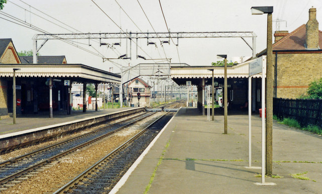
Image: © Ben Brooksbank Taken: 25 May 1991
View eastward, towards Tilbury, Southend-on-Sea and Shoeburyness: ex-Midland (London, Tilbury & Southend) Tilbury Loop line. This was before the HS1 line to St Pancras was built beside it - cf. Image
Images are licensed for reuse under creativecommons.org/licenses/by-sa/2.0
Image Location
Latitude
51.526092
Longitude
0.145887