A bridge over the Donnington Wood Canal
Introduction
The photograph on this page of A bridge over the Donnington Wood Canal by Richard Law as part of the Geograph project.
The Geograph project started in 2005 with the aim of publishing, organising and preserving representative images for every square kilometre of Great Britain, Ireland and the Isle of Man.

There are currently over 7.5m images from over 14,400 individuals and you can help contribute to the project by visiting https://www.geograph.org.uk
A bridge over the Donnington Wood Canal
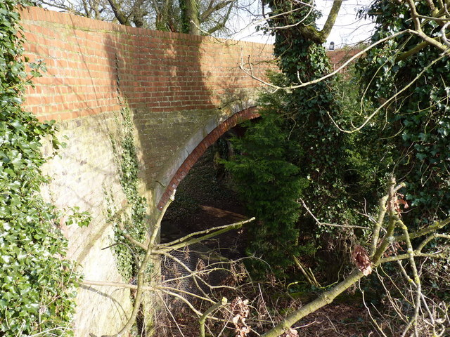
Image: © Richard Law Taken: 4 Apr 2013
The bridge from which Image was taken. It's one of the few remaining visible signs of the former Donnington Wood Canal, which was built in the 1760s to carry coal from mines at Donnington Wood to a road-side wharf near here at Pave Lane. Most of the main canal has succumbed to agricultural changes or subsequent landscaping and industrial developments, but a number of other branches of the canal are more evident, particularly around Lilleshall Image A good description of the canal's construction, usage and history http://en.wikipedia.org/wiki/Donnington_Wood_Canal
Images are licensed for reuse under creativecommons.org/licenses/by-sa/2.0
Image Location
Latitude
52.744038
Longitude
-2.362875