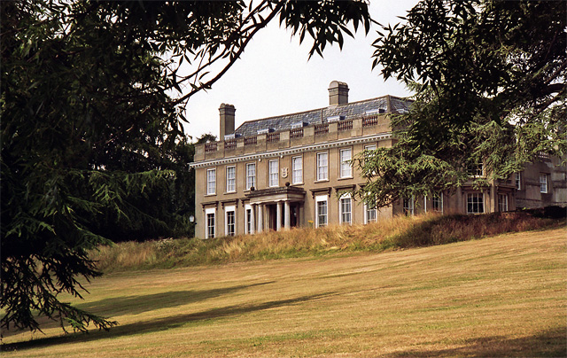
Douce's Manor, West Malling
Introduction
The photograph on this page of Douce's Manor, West Malling by Stephen Richards as part of the Geograph project.
The Geograph project started in 2005 with the aim of publishing, organising and preserving representative images for every square kilometre of Great Britain, Ireland and the Isle of Man.
There are currently over 7.5m images from over 14,400 individuals and you can help contribute to the project by visiting https://www.geograph.org.uk

Image: © Stephen Richards Taken: Unknown
An 1840 refronting of an early C18th house. Rendered, with an emphatic parapet and Tuscan porch. Grade II* listed. At the time of the photo, which is uncertain, I think it was offices but it now seems to have been converted into flats. Douglas Nelson has since told me that in 1999 it was owned by Commercial Union and used as a training and conference centre. An ex-games room/bar is preserved from a period of RAF use during World War Two.

