The Temple
Introduction
The photograph on this page of The Temple by Ian Capper as part of the Geograph project.
The Geograph project started in 2005 with the aim of publishing, organising and preserving representative images for every square kilometre of Great Britain, Ireland and the Isle of Man.

There are currently over 7.5m images from over 14,400 individuals and you can help contribute to the project by visiting https://www.geograph.org.uk
The Temple
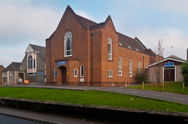
Image: © Ian Capper Taken: 16 Nov 2011
The United Reformed Church for St Mary Cray. The original Temple was built in 1851, a highly ornate structure - see http://www.ideal-homes.org.uk/bromley/assets/galleries/cray-valley/temple for a photo. In 1941 it was severely damaged by a land mine, and by 1950 it had to be closed. It was subsequently demolished, with the replacement building, seen here, opening on 17 November 1955. On its left is the Moffat Hall (see Image) and on its right is the Vernon Hall (see Image).
Images are licensed for reuse under creativecommons.org/licenses/by-sa/2.0
Image Location
Latitude
51.389818
Longitude
0.114465