The Caludon
Introduction
The photograph on this page of The Caludon by David Stowell as part of the Geograph project.
The Geograph project started in 2005 with the aim of publishing, organising and preserving representative images for every square kilometre of Great Britain, Ireland and the Isle of Man.

There are currently over 7.5m images from over 14,400 individuals and you can help contribute to the project by visiting https://www.geograph.org.uk
The Caludon
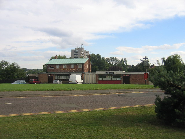
Image: © David Stowell Taken: 5 Aug 2005
A pub built to serve the more recently developed parts of this square, with a block of flats in the south of the square visible over the rooftop. Update from Terry Gaut, Jan 2010: The pub has since been demolished.
Images are licensed for reuse under creativecommons.org/licenses/by-sa/2.0
Image Location


Leaflet Map data © OpenStreetMap
Latitude
52.41404
Longitude
-1.454505