Capel Adulam / Adulam Chapel
Introduction
The photograph on this page of Capel Adulam / Adulam Chapel by Alan Richards as part of the Geograph project.
The Geograph project started in 2005 with the aim of publishing, organising and preserving representative images for every square kilometre of Great Britain, Ireland and the Isle of Man.

There are currently over 7.5m images from over 14,400 individuals and you can help contribute to the project by visiting https://www.geograph.org.uk
Capel Adulam / Adulam Chapel
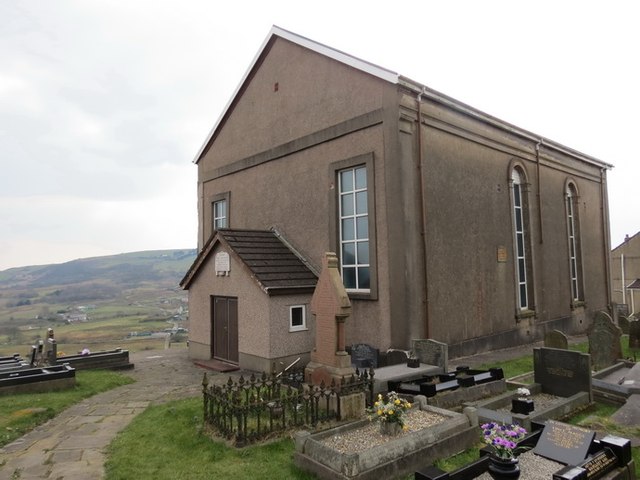
Image: © Alan Richards Taken: 28 Mar 2013
Cyn codi Capel Adulam yn 1850 addolai Bedyddwyr yr ardal mewn annedd-dy o'r enw Ty Draw. Yn ôl y parchedig W. Samlet Williams cynhaliwyd yr eisteddfod cyntaf ym mhlwyf Llansamlet ym mynwent y capel. Roedd côr y capel yn adnabyddus am ei oratorios. Saif y capel ar dir uchel a chyferbyn y safai yr hen felin wynt (neu 'bili wynt' fel y'i gelwid) a ddymchwelyd gan Gyngor Sir Abertawe yn y 1960au er mwyn codi cronfa ddwr ddanddaearol. Yswaeth, nid oedd gan y cyngor y weledigaeth i'w hail-leoli. Before the construction of Adulam Chapel in 1850 local Baptists worshipped at nearby Ty Draw, a large residence. According to the reverend W. Samlet Williams the first ever eisteddfod within the parish of Llamsamlet was held here. The chapel choir was also well known for its oriatorios. The chapel stands on a high ridge and opposite stood the old windmill or 'felin wynt or bili wynt' as it was known locally. Sadly, to make way for an underground reservoir this monument was demolished during the 1960s by Swansea Council who didn't have the foresight to have it relocated.
Images are licensed for reuse under creativecommons.org/licenses/by-sa/2.0
Image Location
Latitude
51.641098
Longitude
-3.906385