Heights Lane re-opened
Introduction
The photograph on this page of Heights Lane re-opened by Richard Kay as part of the Geograph project.
The Geograph project started in 2005 with the aim of publishing, organising and preserving representative images for every square kilometre of Great Britain, Ireland and the Isle of Man.

There are currently over 7.5m images from over 14,400 individuals and you can help contribute to the project by visiting https://www.geograph.org.uk
Heights Lane re-opened
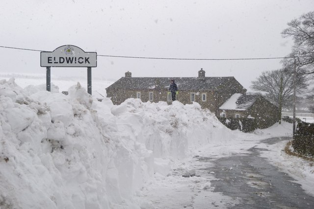
Image: © Richard Kay Taken: 27 Mar 2013
Heights Lane had been closed during the snowstorm of 22/23 March 2013, and the road closure signs were still in place in the village of Eldwick, when this photo was taken. Passable with suitable tyres. Compare the photo taken at the same time of year in 2009 in Image
Images are licensed for reuse under creativecommons.org/licenses/by-sa/2.0
Image Location
Latitude
53.86248
Longitude
-1.823888