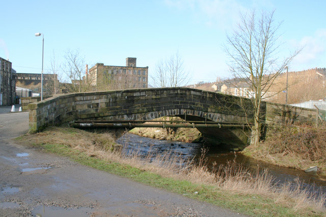
Waterside Bridge, Colne, Lancashire
Introduction
The photograph on this page of Waterside Bridge, Colne, Lancashire by Dr Neil Clifton as part of the Geograph project.
The Geograph project started in 2005 with the aim of publishing, organising and preserving representative images for every square kilometre of Great Britain, Ireland and the Isle of Man.
There are currently over 7.5m images from over 14,400 individuals and you can help contribute to the project by visiting https://www.geograph.org.uk

Image: © Dr Neil Clifton Taken: 14 Feb 2007
The ancient Lancashire town of Colne is built on high ground between two valleys, which run roughly east to west, about a mile apart. The southerly valley is that of Colne Water, which is seen here passing under Waterside Bridge. Spring Gardens Mill is seen in the distance. A site visitor adds: I believe Spring Gardens Mill was on the left of the picture (beyond where the white cones are) and the Mill in the distance is Haslems Mill. We used to climb up the inside of the tower of Haslems and play on the roof in our early teens. My Grandparents used to live on Spring Garden St.
Image Location


