Former end of College Street
Introduction
The photograph on this page of Former end of College Street by Lairich Rig as part of the Geograph project.
The Geograph project started in 2005 with the aim of publishing, organising and preserving representative images for every square kilometre of Great Britain, Ireland and the Isle of Man.

There are currently over 7.5m images from over 14,400 individuals and you can help contribute to the project by visiting https://www.geograph.org.uk
Former end of College Street
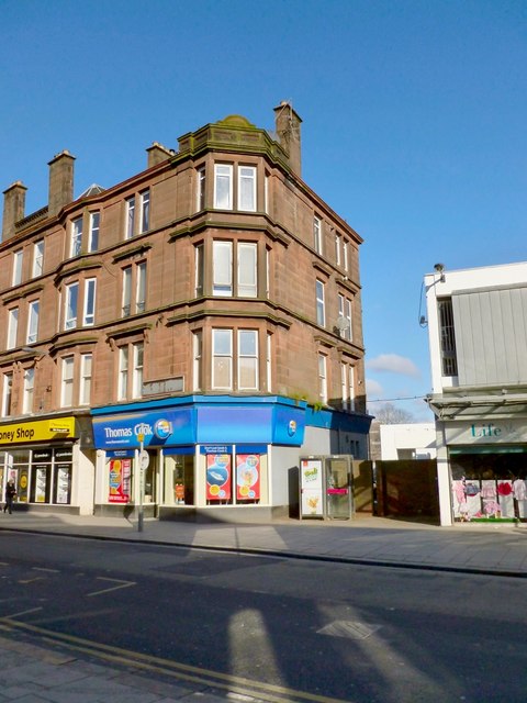
Image: © Lairich Rig Taken: 21 Feb 2013
Of the three main streets of the medieval burgh of Dumbarton, the High Street of that time followed the same course as the present-day High Street, which is shown in the foreground of this picture (and in Image / Image / Image). Likewise, the Kirk Vennel follows its original course, although it is now called Church Street (Image / Image). The third main street of the medieval town was the Cross Vennel, which was later called College Street (the old "College" was the Collegiate Church; see Image). Its junction with the High Street was at the point shown in this picture, where there are phone boxes in the gap between the buildings. The sandstone terrace therefore stood on the corner. [For more information, see "Historic Dumbarton: the Scottish burgh survey" (Dennison/Coleman, 1999).] This former junction (which faces Image across the High Street) is about 30 metres to the west of the entrance to the Artizan Centre (Image / Image). The walkway through the Artizan Centre is therefore close to, but not the same as, the former course of the Cross Vennel / College Street.
Images are licensed for reuse under creativecommons.org/licenses/by-sa/2.0
Image Location
Latitude
55.943415
Longitude
-4.571351